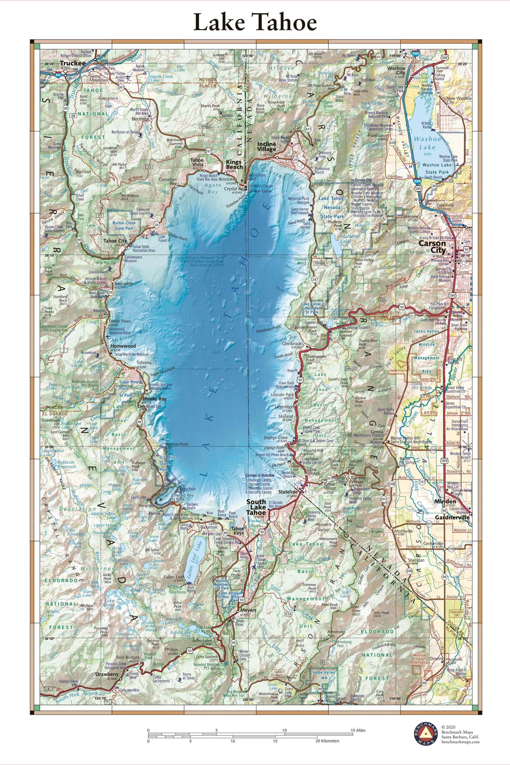
This 30″ x 40″ wall map illustrates Lake Tahoe, one of the largest and deepest lakes in North America. The surrounding peaks of the Sierra Nevada Mountains, shared by California and Nevada, contain a wealth of recreation opportunities and some of America’s most scenic drives. Map highlights include bathymetric shading of the lake floor, public land types & boundaries, recreation points of interest, and several highway approaches to the lake shore.
Each wall map is individually printed on high quality semi-matte photo paper, then rolled and shipped in a tube from our cartography hub in Medford, Oregon.


