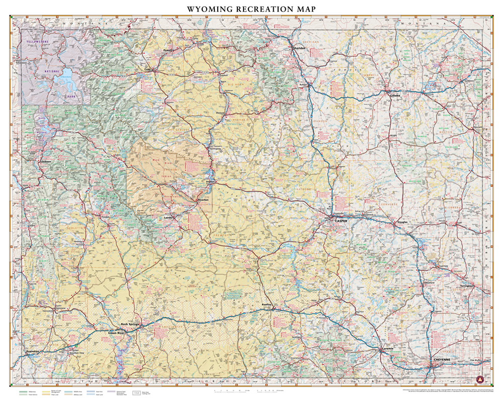
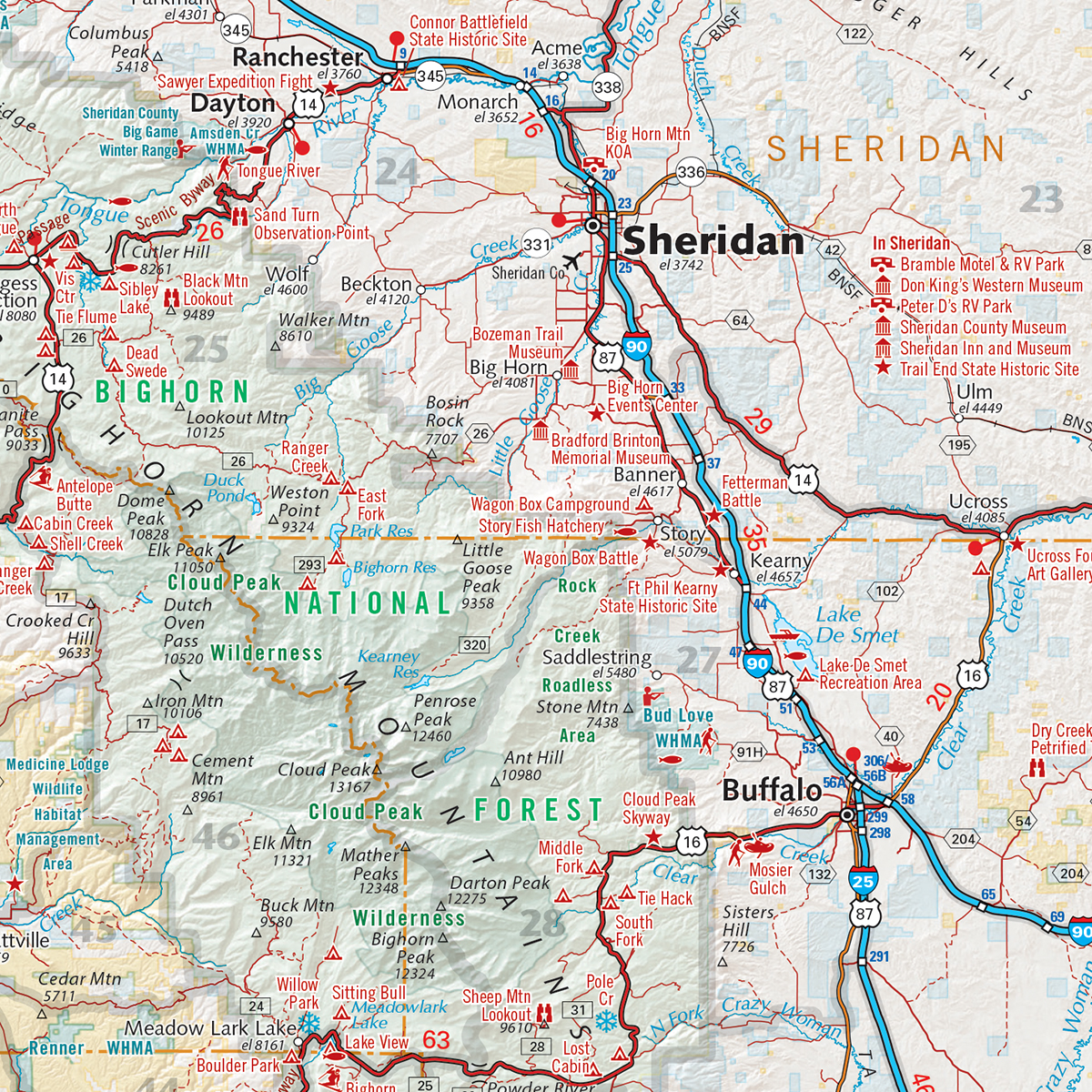
This wall map is made from our folded Wyoming Recreation Map but with a slightly larger sheet size for prominence on your wall. It highlights road & recreation information including public lands, parks & monuments, boating & fishing access, hunting unit boundaries, campgrounds, historic sites, point-to-point distances, and more. Each map is individually printed on high quality paper, hand-trimmed, and shipped from our cartography offices in Medford, Oregon.
Dimensions: 40″ w x 32″ h


